價格:免費
更新日期:2017-11-08
檔案大小:90 MB
目前版本:05.05.09
版本需求:需要 iOS 9.0 或以上版本。與 iPad 相容。
支援語言:英語

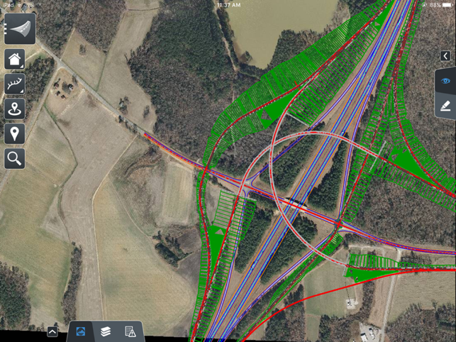
OpenRoads Navigator is an easy-to-use, dynamic mobile software that provides quick access to civil data in the field. You can interactively view, analyze, and augment a wide variety of project information, including reviewing existing terrain, 3D models, and 2D topographies. Improve project coordination and accelerate collaboration through faster reliable capture of feedback from field staff. The result is better decisions throughout the lifecycle of a project, while minimizing risk.

With OpenRoads Navigator, you can work better together to speed approvals and resolve issues during design, construction, and operations. Use the app to combine design artifacts with pay item tracking for field inspection. You can take advantage of integrated GPS in both 2D and 3D models with linear and physical coordinate systems. You can collaborate between office, site, and field to gain insight into project planning and execution for faster resolution of issues found in the field. OpenRoads Navigator integrates with ProjectWise to support collaboration with all team members.

支援平台:iPad
